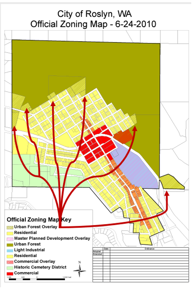
What exactly is an "overlay" and how does it impact our forest?
Several parcels of land in the Urban Forest are not owned by the City of Roslyn. The "Overlay" is a specific zone and not a part of the Roslyn Urban Forest.
In 2010, 15 parcels totaling ~23 acres were zoned as an Urban Forest Overlay. That's less than 10% of the City-owned parcels that make up the nearly 300 acres of protected land which is known as the Roslyn Urban Forest.
This designation of the "Overlay" was intended to provide a framework for property owners adjacent to the Roslyn Urban Forest to responsibly interact with the forest (e.g., details provided in the Land Stewardship Plan).
The Urban Forest Overlay was decided on at a time when the region of Upper Kittitas County was undergoing intense development. Members of the community banded together and petitioned for the overlay zone to protect the Urban Forest from intense development. In a way, the "Overlay" act as a buffer to the forest and established a well-defined "greenbelt" around the City of Roslyn.
The Roslyn Municipal Code currently allows one residence per 20-acre plot (RMC 18.80.040.D.1). However, no parcel exists in the Urban Forest Overlay zone that can accommodate the current development code. Additionally, the "Overlay" was established after some parcel owners had purchased the land. Whereas another majority of landowners in this zone purchased the property with existing knowledge of the forest overlay. Therefore, the fair use of these private properties is compromised by the current codes, which as a result, needs to receive adequate consideration from the community to determine if the current zoning designation is relevant to the property owners of Roslyn and the City's Comprehensive Plan.
It may be helpful to note that many of these parcels present engineering challenges (i.e., steep slopes, rock outcroppings, and protected streams) which would require careful planning and extensive permitting to develop.
See the Official Zone map below for more context: